| Temperature Map Index | Brief Description | Technical Article | Potential Temperature Index |
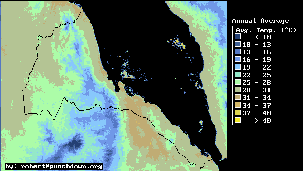
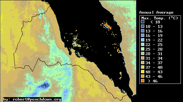
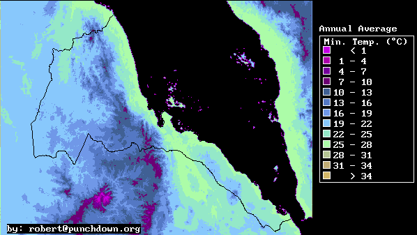
Annual Average Temperature
| WINTER | SPRING | SUMMER | AUTUMN |
| Temperature Map Index | Brief Description | Technical Article | Potential Temperature Index |
| WINTER | SPRING | SUMMER | AUTUMN |
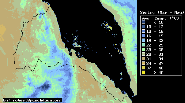
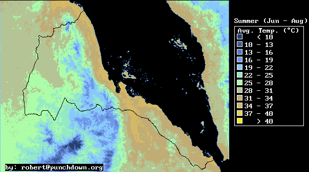
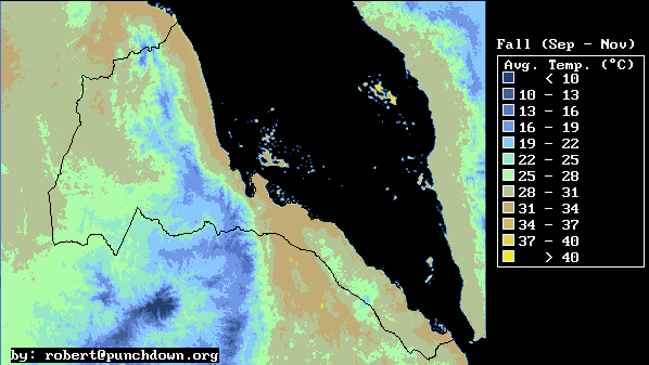
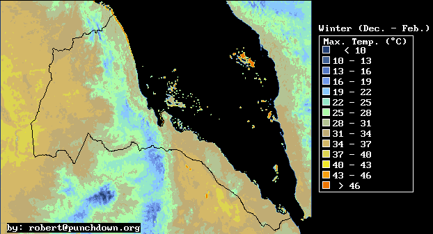
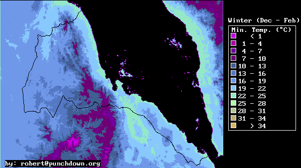
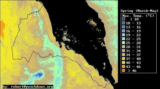
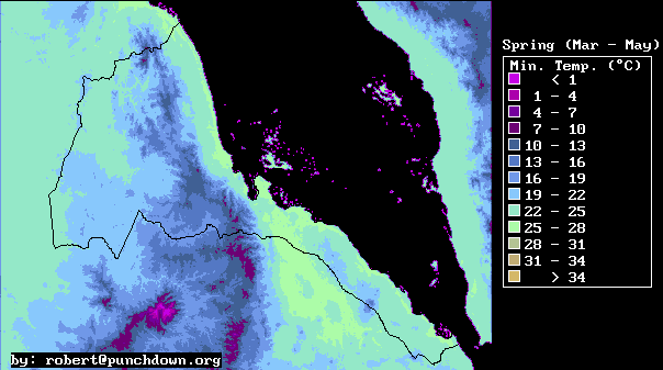
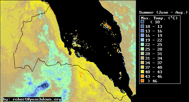
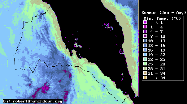
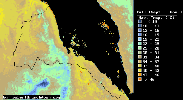
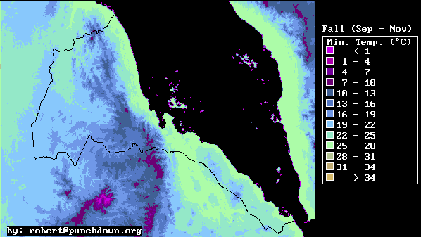
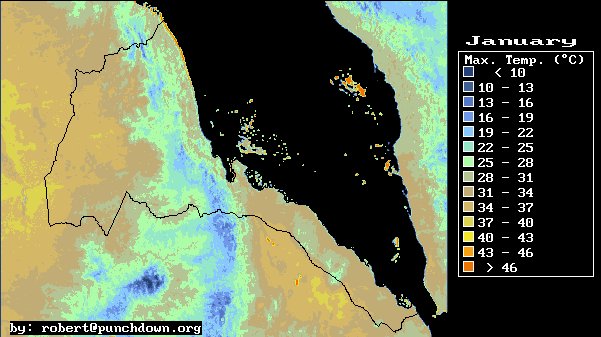
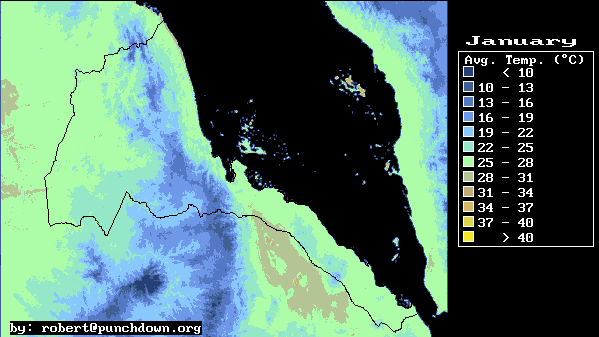
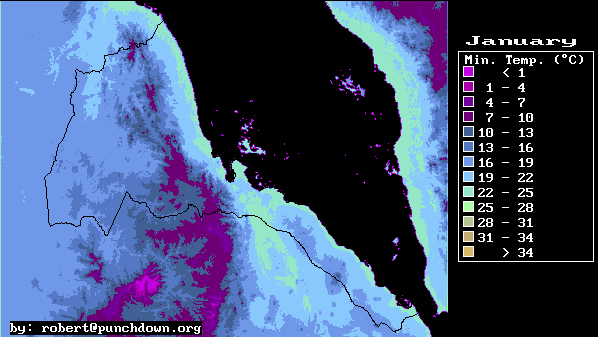
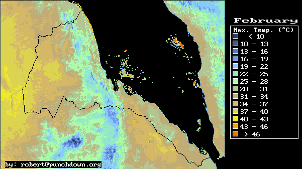
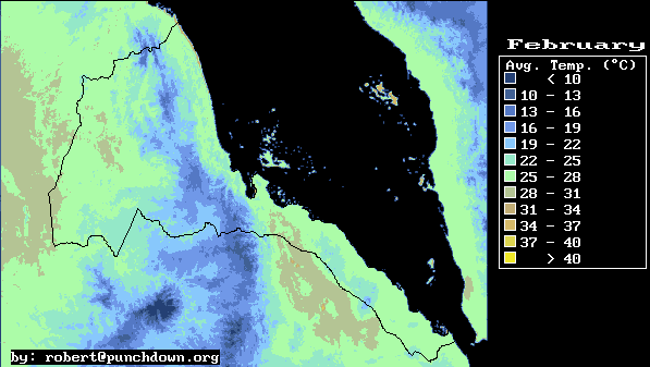
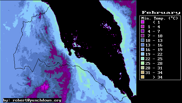
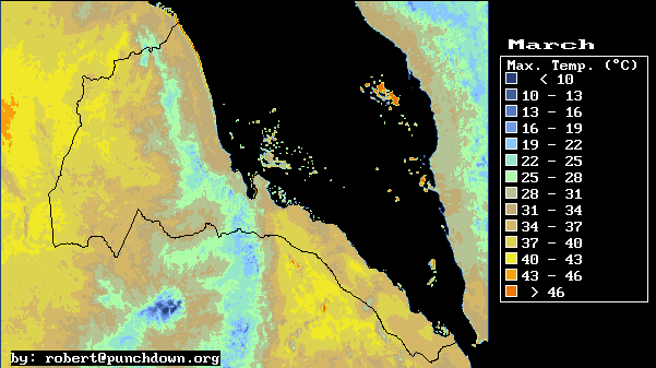
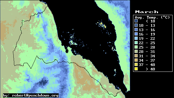
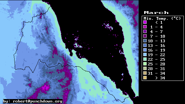
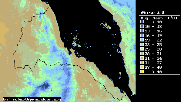
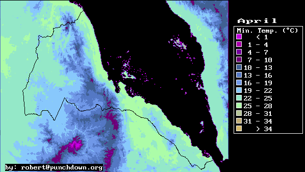
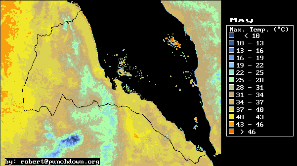
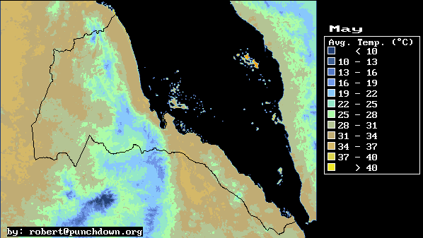
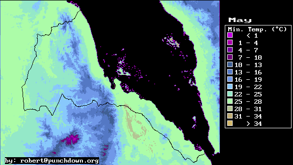
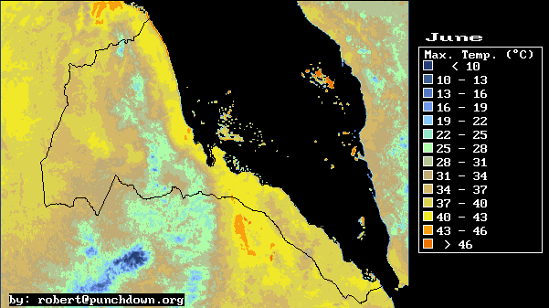
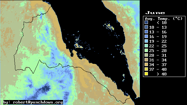
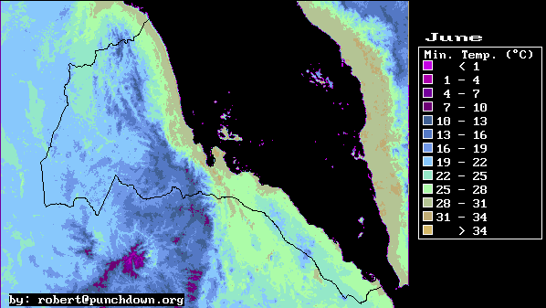
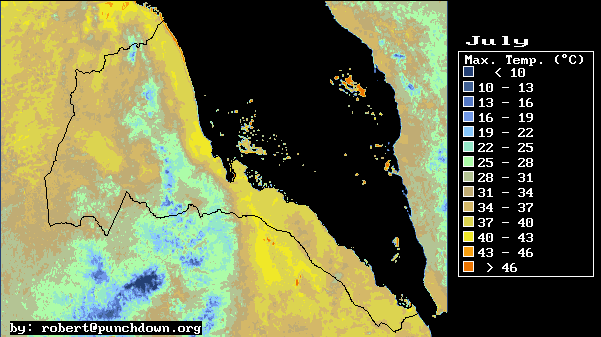
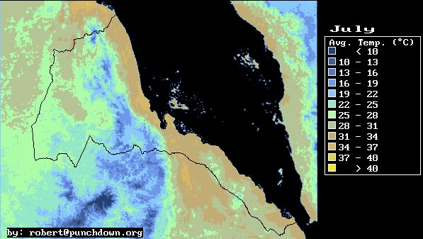
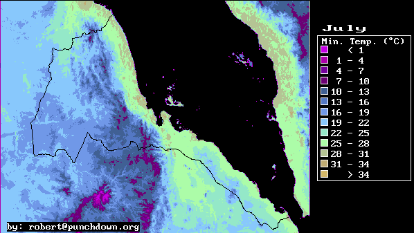
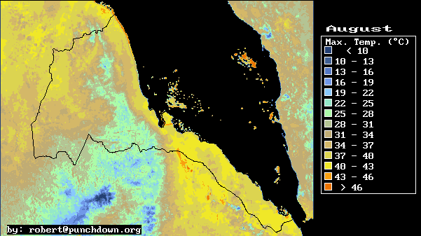
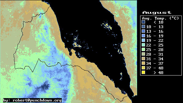
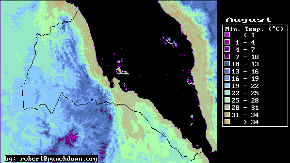
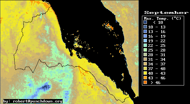
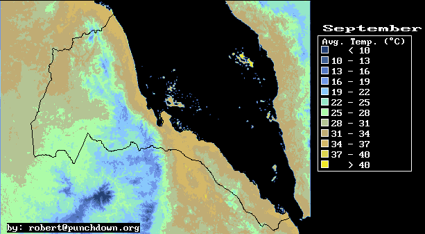
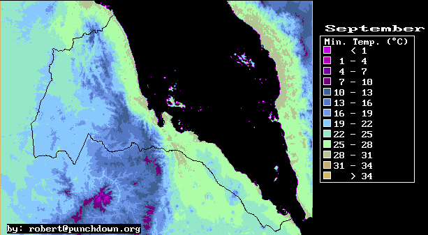
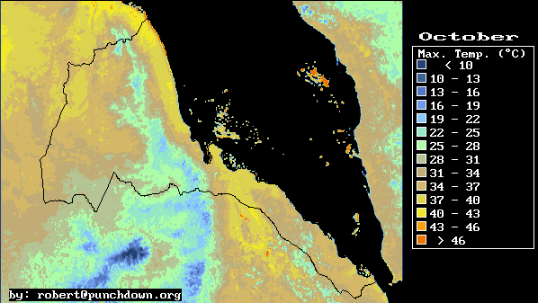
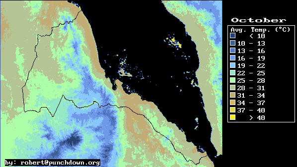
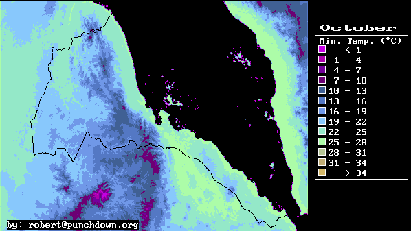
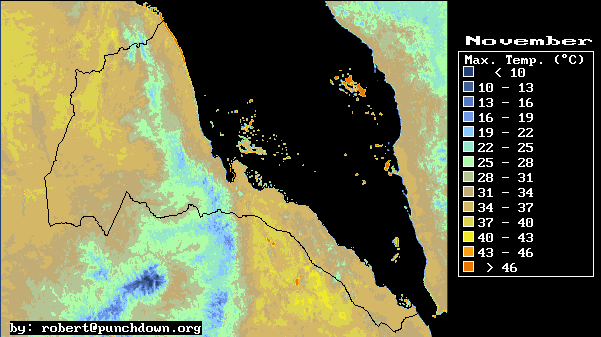
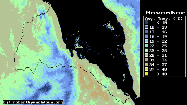
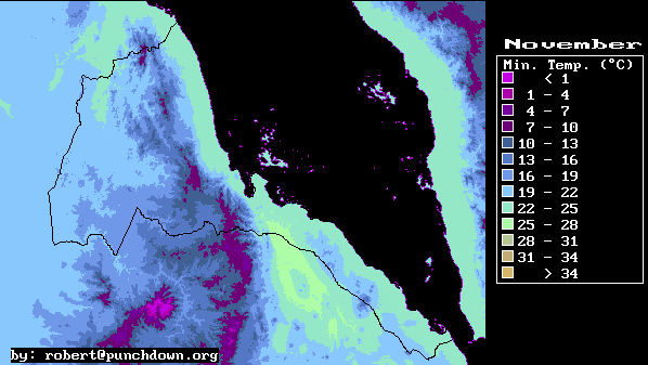
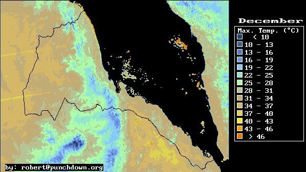
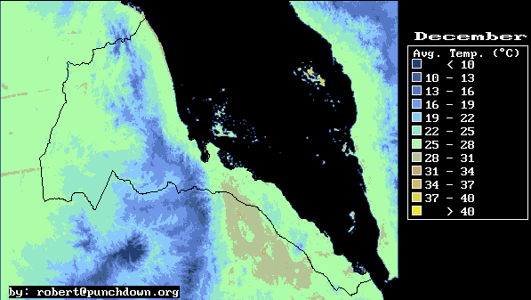
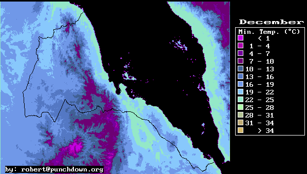
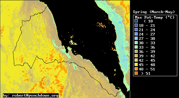
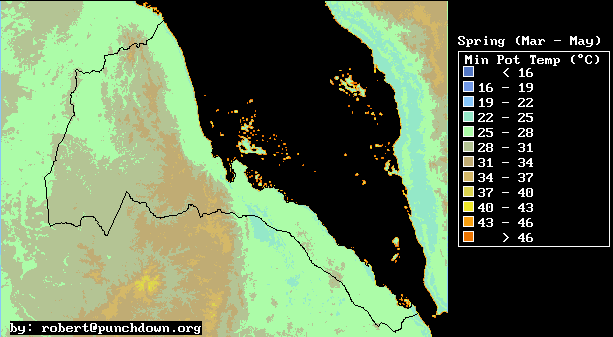
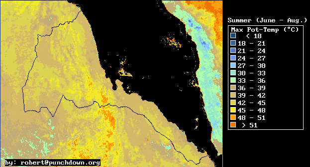
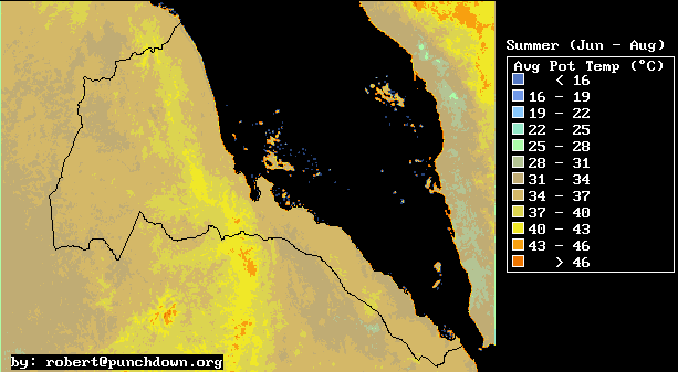
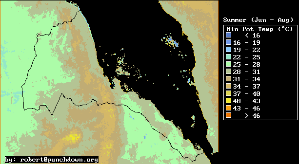
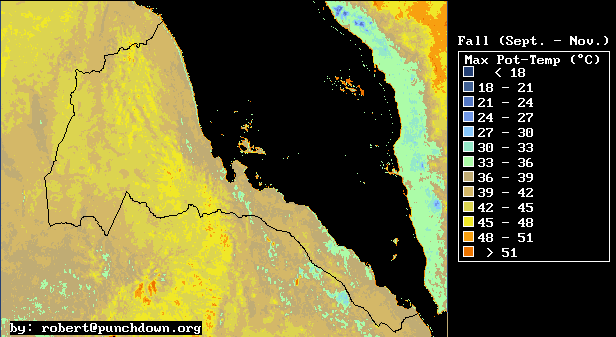
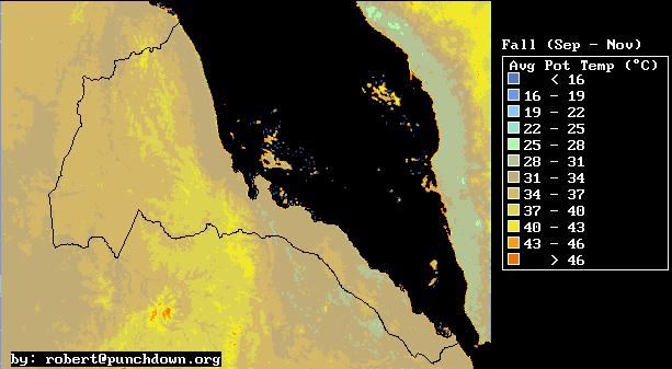
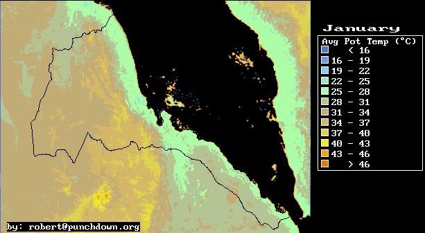
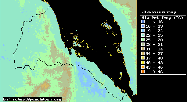
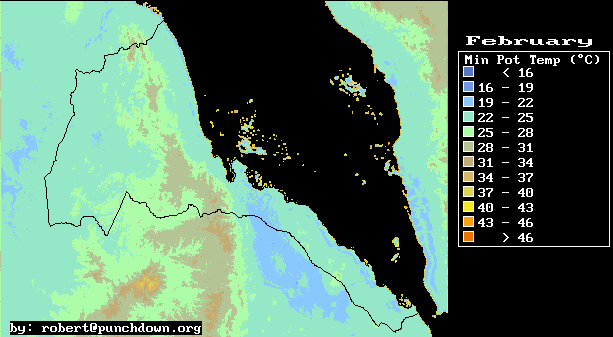
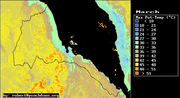
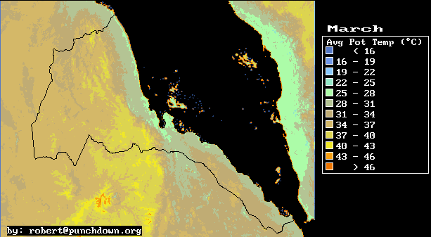
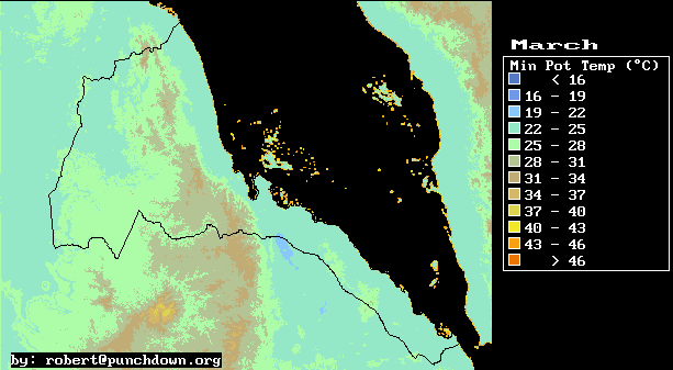
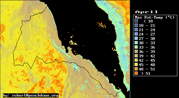
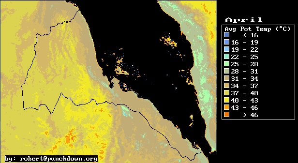
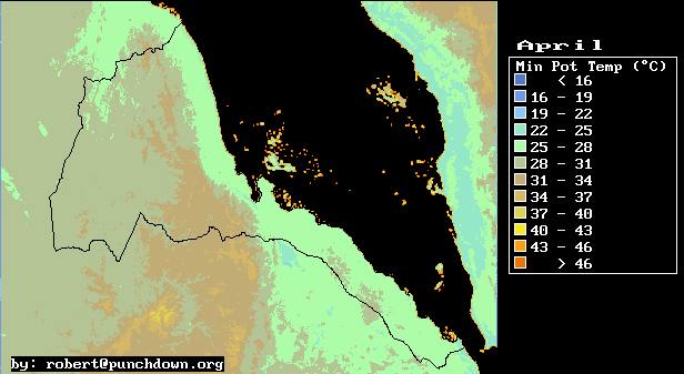
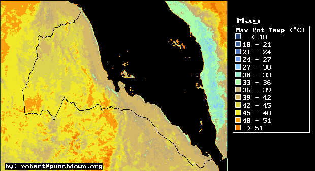
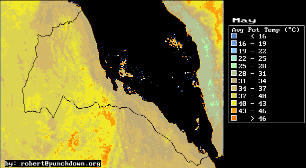
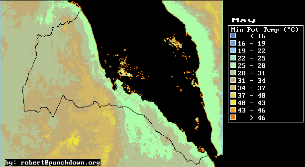
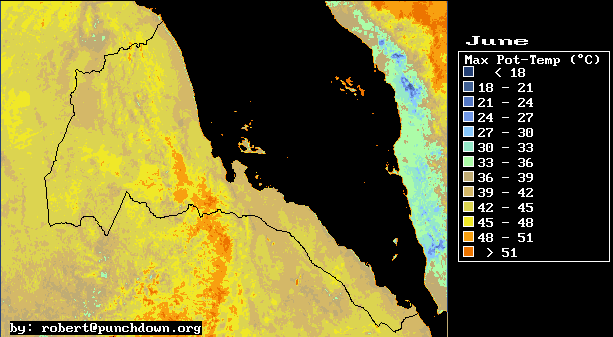
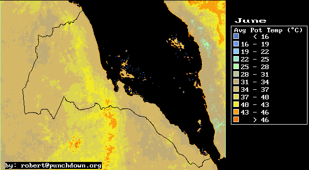
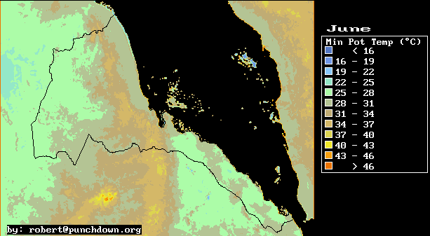
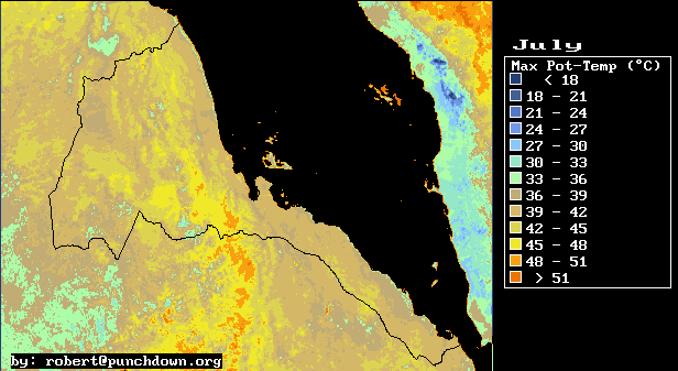
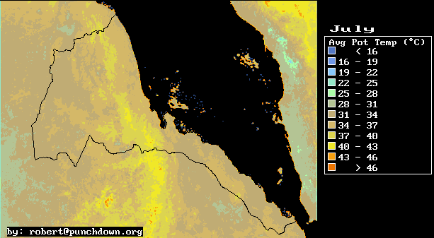
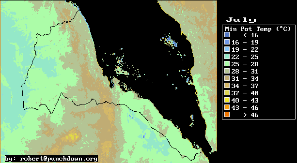
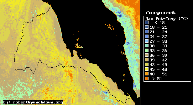
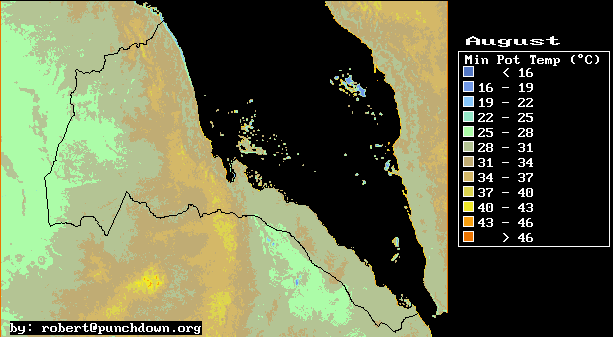
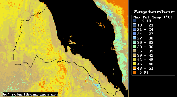
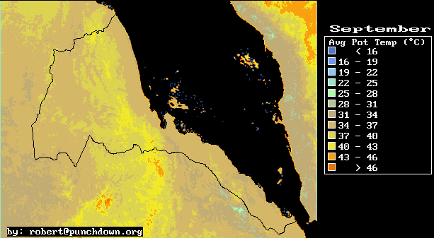
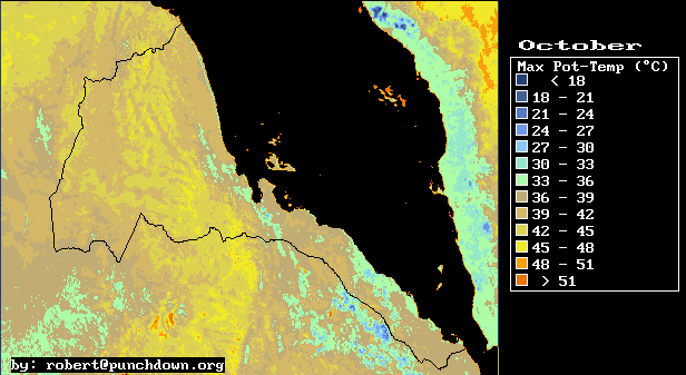
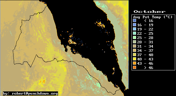
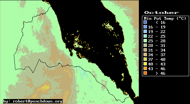
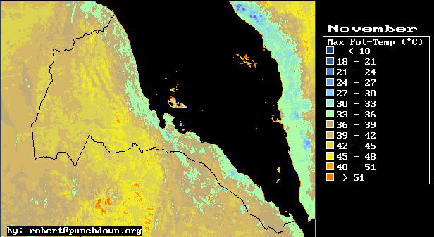
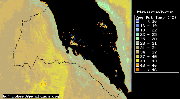
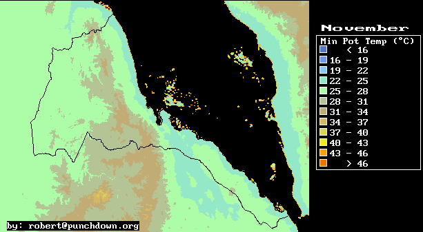
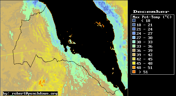
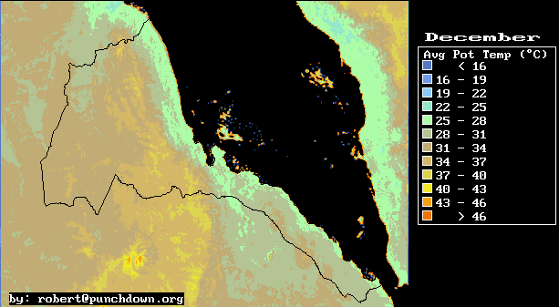
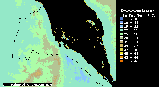
Here we provide maps of mean daily maximum, average, and minimum temperature. We also provide such maps for potential temperature, which is temperature with simple altitude effects factored out.
The maps were derived from Advanced High Resolution Radiometer data obtained from public archives at the U.S. Geologic survey. We used AVHRR Channel 5 thermal infrared images, and correlated this data and station elevation with mean daily temperatures as reported in the classic work on Eritrea meteorology and climate: Contributo all Climatologia Dell'Altopiano Etiopico, Regione Eritrea by Amilcare Fantoli, 1966.
The root mean square deviation between the data and the estimates ranges from approximately 1 to 3 degrees C.
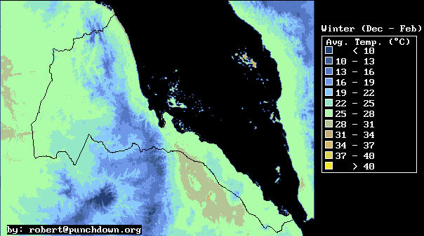
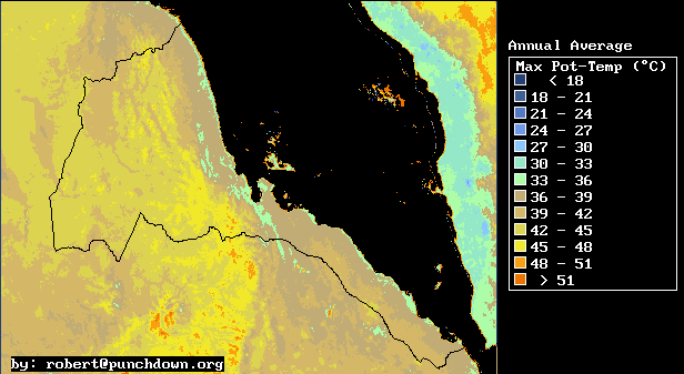
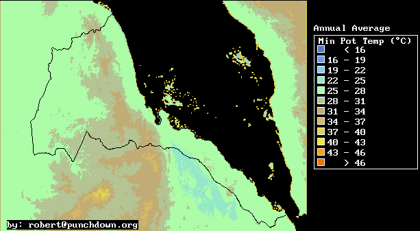
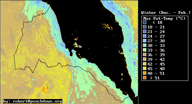
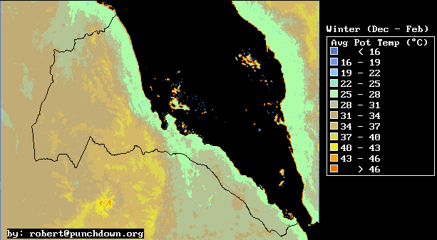
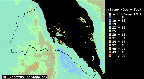
Potential temperature is the temperature that the air would have if it was moved, without heat exchange, to sea level. We provide potential temperature maps so that one can see the temperature of the different air masses, when altitude effects are factored out. These maps are instructive for meteorological analysis.
For example, the winter potential temperature maps show very clearly a cool layer of marine air, which is 1000 to 1500 meters thick during the Winter season. At night, this layer is fairly quiescent, and distributed on both sides of the Eritrean Highlands. During the day, the air in the Western lowlands and Danakil depression heats up quickly, While the air over the Red Sea stays relatively cool. This causes winds in the Red sea to converge at Port Sudan where the cool marine layer moves inland, and causes a strong on-shore wind at the Northern end of the Danakil depression at Tio. The fact that marine air is drawn in at both the Danakil and Port Sudan means that high winds are experienced at Aseb where marine air is drawn in from the Gulf of Aden through the constriction at Bab al Mandab. This provides a rough explanation of the winter season wind patterns over the South Red Sea.
| Daily Maximum Temperature | Daily Average Temperature | Daily Minimum Temperature | |||||||||||||||||||||||||||||||||||||||||||||||||||
| Annual Average | Annual Average | Annual Average
| Winter Average
| Winter Average
| Winter Average
| Spring Average
| Spring Average
| Spring Average
| Summer Average
| Summer Average
| Summer Average
| Fall Average
| Fall Average
| Fall Average
| January
| January
| January
| February
| February
| February
| March
| March
| March
| April
| April
| April
| May
| May
| May
| June
| June
| June
| July
| July
| July
| August
| August
| August
| September
| September
| September
| October
| October
| October
| November
| November
| November
| December
| December
| December
| 12-Month Display
(400 Kilobytes)
| 12-Month Display
(400 Kilobytes)
| 12-Month Display
(400 Kilobytes)
| |
| Daily Max. Potential Temp. | Daily Avg. Potential Temp. | Daily Min. Potential Temp. | |||||||||||||||||||||||||||||||||||||||||||||||||||
| Annual Average | Annual Average | Annual Average
| Winter Average
| Winter Average
| Winter Average
| Spring Average
| Spring Average
| Spring Average
| Summer Average
| Summer Average
| Summer Average
| Fall Average
| Fall Average
| Fall Average
| January
| January
| January
| February
| February
| February
| March
| March
| March
| April
| April
| April
| May
| May
| May
| June
| June
| June
| July
| July
| July
| August
| August
| August
| September
| September
| September
| October
| October
| October
| November
| November
| November
| December
| December
| December
| 12-Month Display
(400 Kilobytes)
| 12-Month Display
(400 Kilobytes)
| 12-Month Display
(400 Kilobytes)
| |
This information has been prepared by Robert Van Buskirk. If you have any questions regarding some of this research please feel free to email me at robert@punchdown.org
I enjoy both visiting and working in Eritrea, and am available for both short term consultations and technical training seminars.
Last update by rvb September 13, 1998.