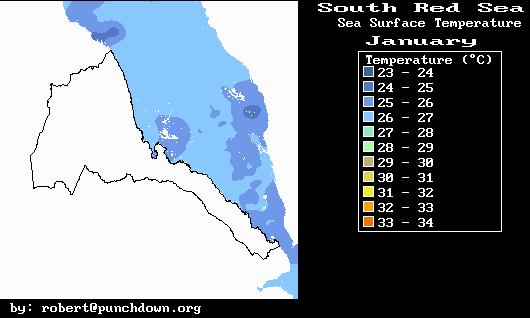
January
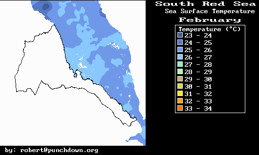
February
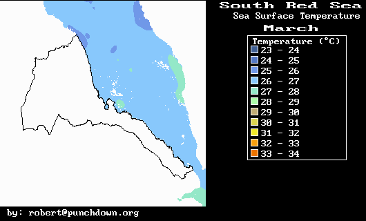
March
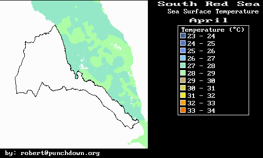
April
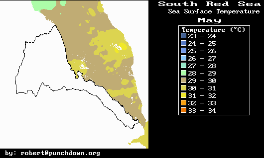
May
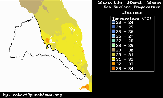
June
July
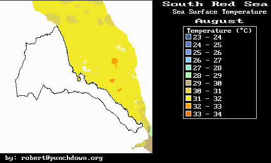
August
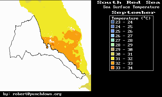
September
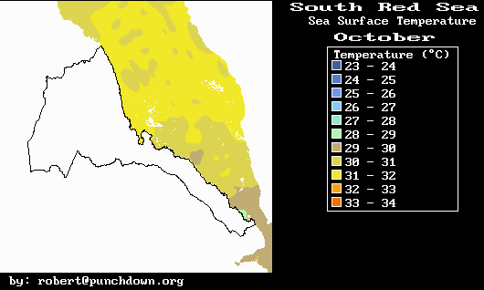
October
November
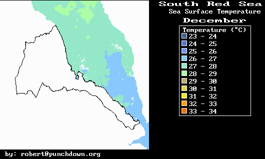
December
Home
SST Data is useful for both oceanographic and meteorological analyses. Sea temperatures are important elements in the evaluation of fish habitat, ocean currents, and fish habits and behaviors. For example, the high surface temperatures in June, July, August and September prompt many fish species to inhabit deeper waters during this period. This fish behavior is responsible for the fact that during the summer, fishery production is low compared to the winter months.
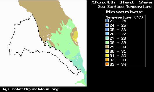
Heat stored in South Red Sea waters also has several local meteorological implications. The above November SST map illustrates clearly the temperature differences between the Gulf of Aden and the South Red Sea near Eritrea. These temperature differences help strengthen the winds near Aseb where cool Gulf of Aden marine air tends to flow towards the warmer Red Sea waters near the central Eritrean Coast. Furthermore, the warm Red Sea waters produce significant amounts of water vapor which increases humidity in the Red Sea basin. This water vapor then condenses as fog and low stratus clouds during the winter season along the Red Sea slopes of both the Eritrean and Yemeni highlands. Such clouds are an important source of precipitation and rainfall enhancement along Eritrea's Eastern Escarpment.
The water vapor from the Red Sea is also an important source of latent
heat. This latent heat is released upon condensation of the water
vapor. It is an important energy source for driving the South
Red Sea convergence zone. During the winter months this convergence zone
produces clouds and precipitation between about 15° and 20° North
latitude and is responsible for the winter rains along the Eritrean eastern
escarpment.