Other Rainfall Maps
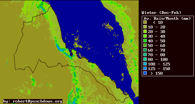
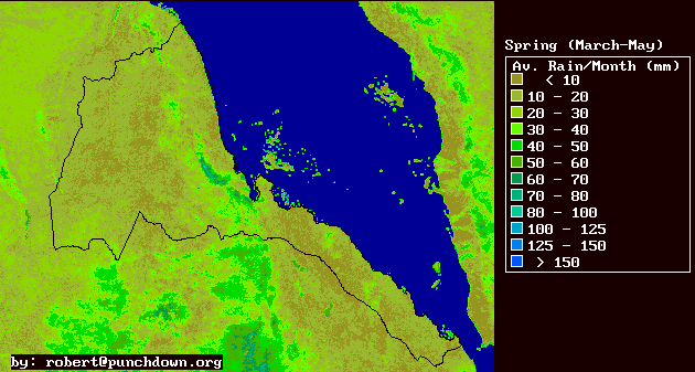
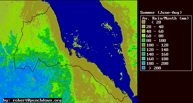
| WINTER | SPRING | SUMMER | AUTUMN |
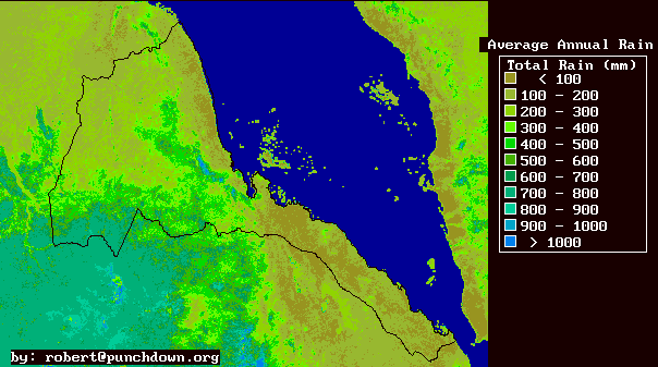
Eritrea is currently an arid to semi-arid agricultural and agro-pastoralist country. Agricultural production, which comprises the majority of the national economy, is constrained mostly by the availability of water resources either as rainfall, runoff or groundwater. The geographic variations in Eritrean rainfall distributions are extreme, with areas of 1000 mm annual rainfall and 200 mm of annual rainfall separated by as little as 15 kilometers.
We present here some of the first attempts to characterize rainfall distributions in Eritrea with high spacial accuracy, and a resolution of finer than 10 kilometers. While these efforts will necessarily require further refinements to improve accuracy, we consider them an essenitial component of a national environmental and development information system.
| WINTER | SPRING | SUMMER | AUTUMN |
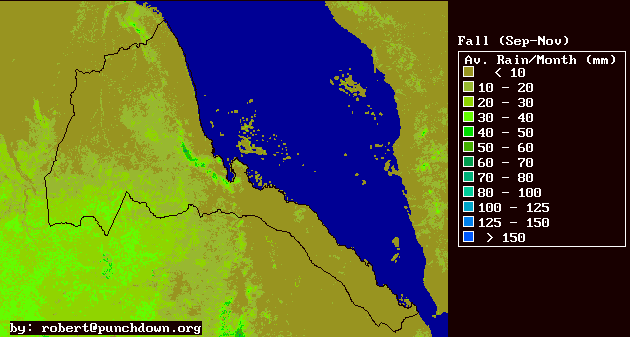
This is a 20% accurate map of the average annual rainfall distribution in Eritrea. The map is not accurate outside of Eritreas boundaries.
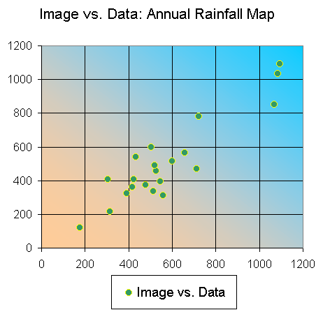
Click HERE to see a plot which compares the historic data with the rainfall estimates provided in the map.
The map is reasonably accurate (for a rainfall map), especially in the western lowlands, and along the eastern escarpment. It overestimates rainfall in the northern highlands by about 50-100 mm. It also probably underestimates rainfall in the southern highlands below 15 degrees North latitude and East of 38.75 degrees East longitude. Underestimates in the southern highland zone are probably about 100 mm.
The map was produced from monthly maps that were derived by correlating historic monthly average rainfall with averaged Normalized Difference Vegetation Index (NDVI) images from the 1990's. Elevation was also sometimes used in the correlation analysis, as were regional climate zone masks (which divided Red Sea basin climate zones from the inland climate zones. The climate zone masks were derived from potential temperature images).
If you have any questions regarding some of this research, please feel free to email me at robert@punchdown.org
You are free to use this information for the benefit of Eritrea's future development under two conditions: (1) You credit the authors in any report or presentation of the data and (2) You send a short note to me explaining how you are using or applying the information. The notes I receive will give me an indication of what is usefull and what is not. And they will also give me a chance to provide you with any updates, corrections, or further details.