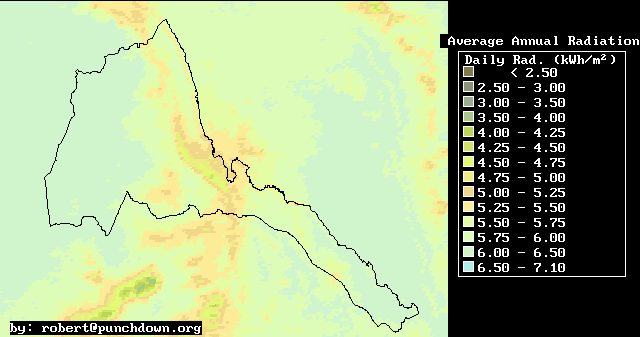
Annual Average Solar Radiation
| WINTER | SPRING | SUMMER | AUTUMN |
| Solar Radiation Map Index | Brief Description |
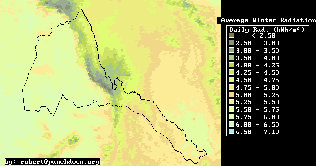
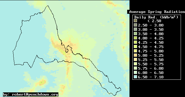
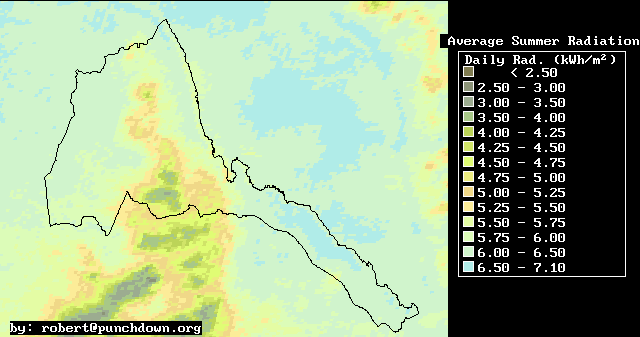
Solar radiation maps are an important piece of information for Eritrean development planning for several reasons. First, solar Photovoltaic (PV) electricity systems with over 200 kilowatts of installed capacity are a major supplier of high-value energy in isolated rural villages in Eritrea. Solar radiation maps can aid in the design and in the optimization of such solar PV systems. Secondly, solar radiation is an important input into agroclimatological and meteorological models. Therefore solar radiation maps will be valuable for calculating daily temperature variations both in the air and in the soil, and in formulating models of Eritrean meteorology.
| WINTER | SPRING | SUMMER | AUTUMN |
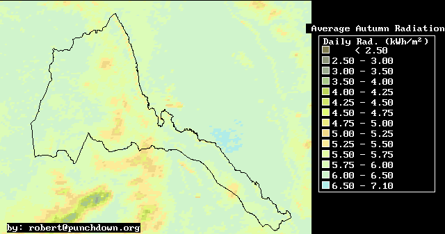
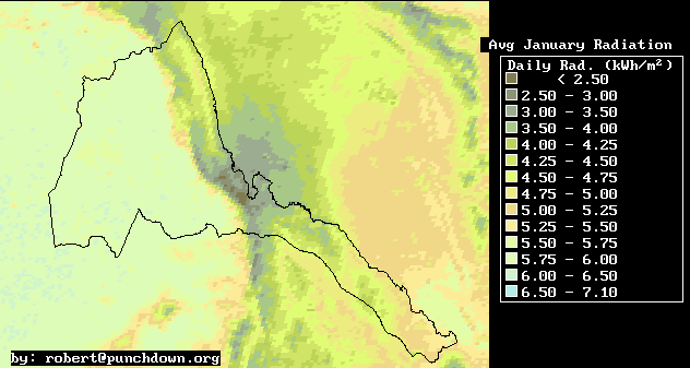
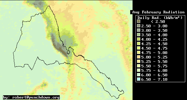
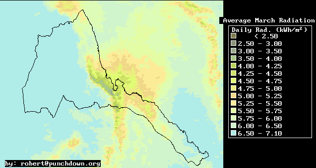
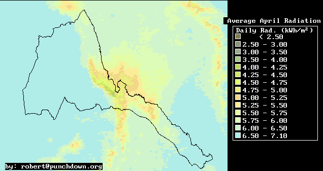
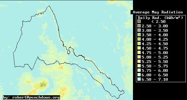
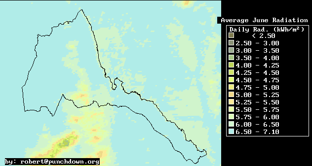
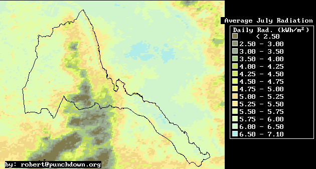
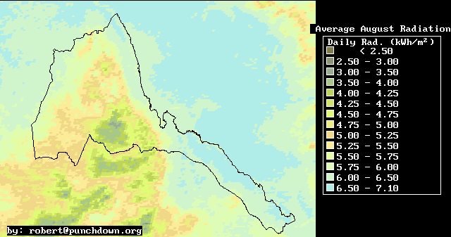
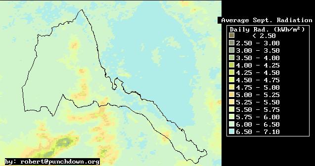
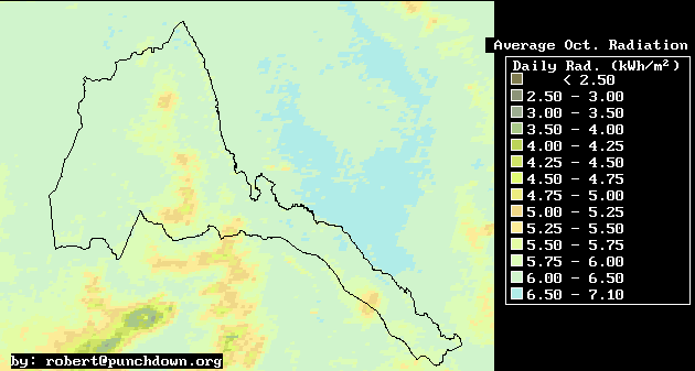
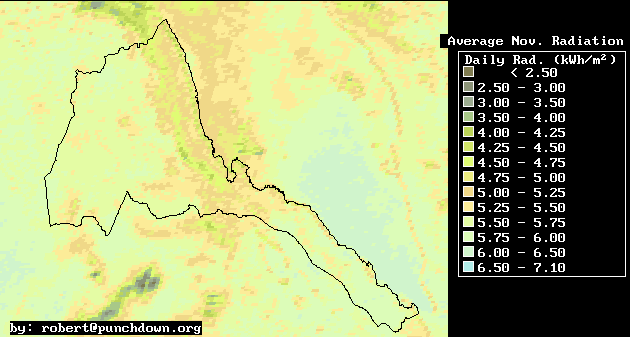
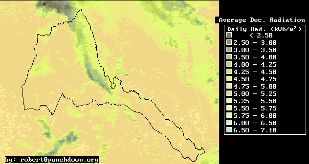
Here we provide maps of mean daily global, horizontal solar radiation for Eritrea.
The maps were derived from visible meteosat images, where mean cloud reflectance was correlated with average daily horizontal solar radiation. The correlation of data with image pixel values has a mean error of about 250 Watts/square-meter/day
| Daily Mean Radiation | |||||||||||||||||
Annual Average
| Winter Average
| Spring Average
| Summer Average
| Fall Average
| January
| February
| March
| April
| May
| June
| July
| August
| September
| October
| November
| December
| 12-Month Display
(400 Kilobytes)
| |
This information has been prepared by Robert Van Buskirk. If you have any questions regarding some of this research please feel free to email me at robert@punchdown.org
Last update by rvb September 13, 1998.