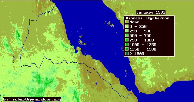
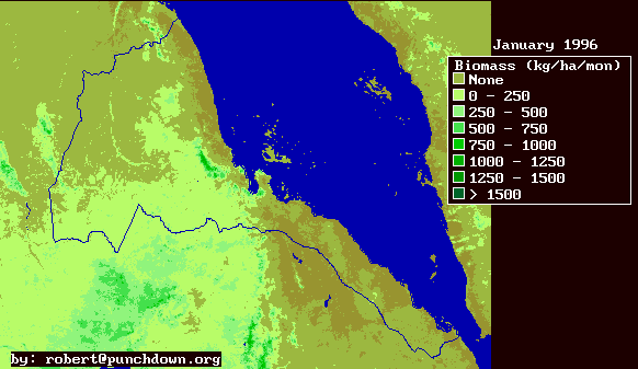
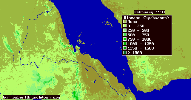
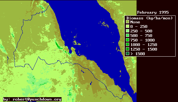
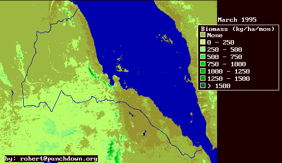
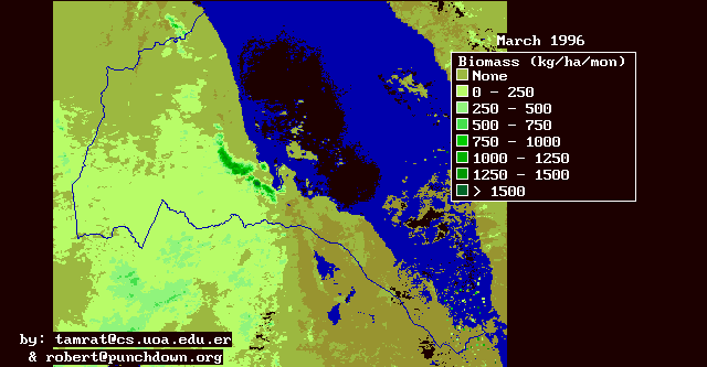
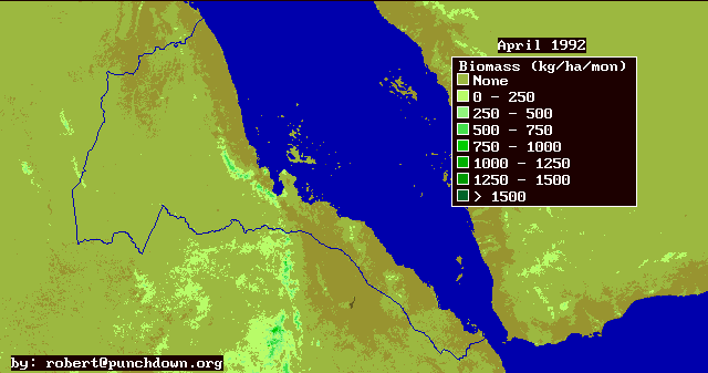
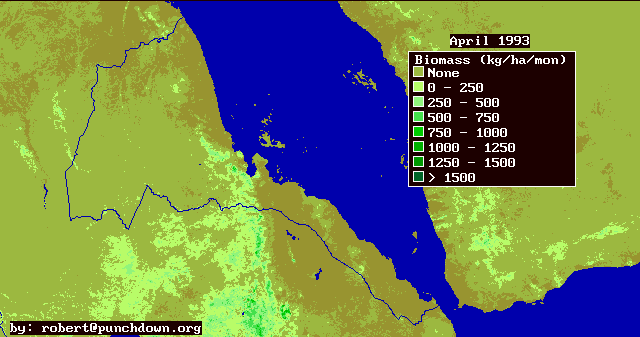
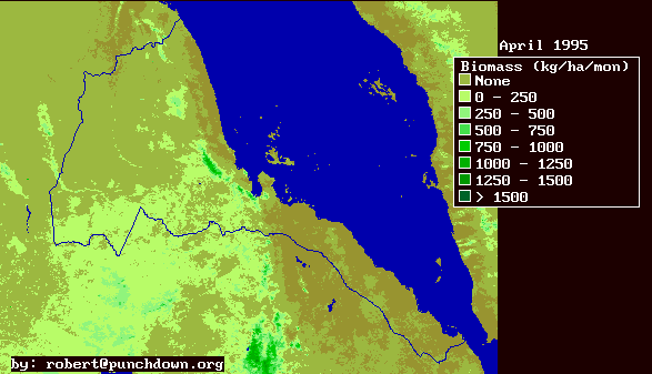
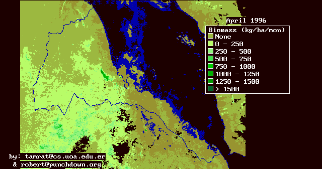
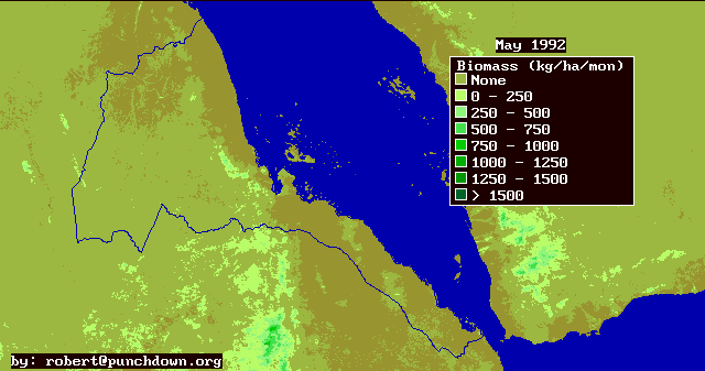
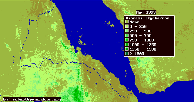
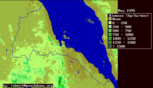
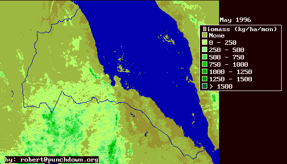
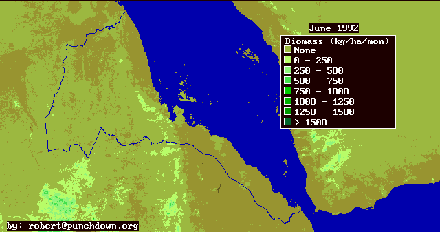
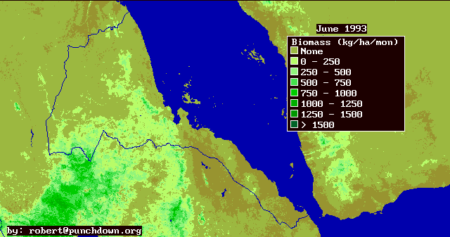
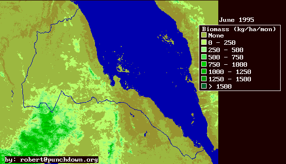
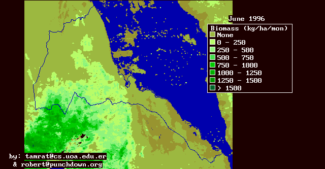
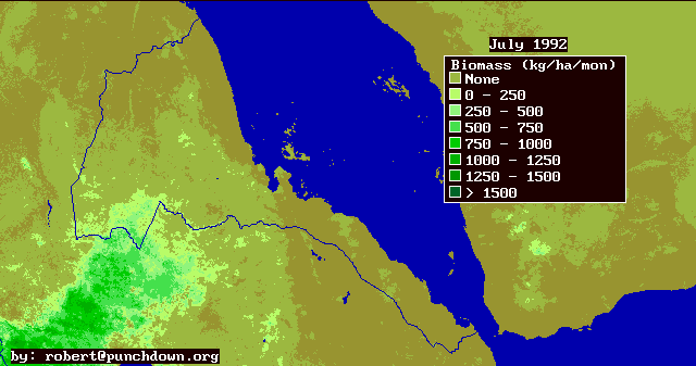
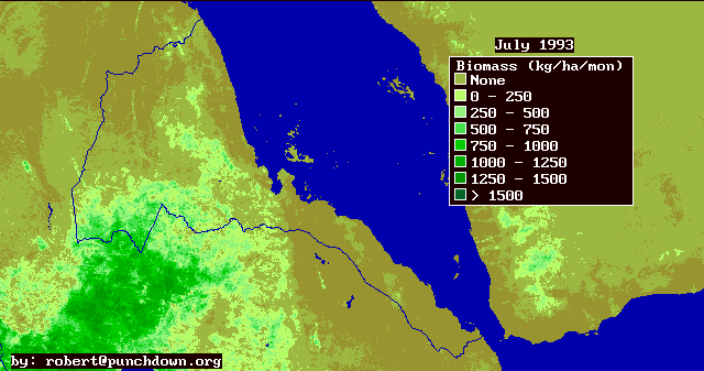
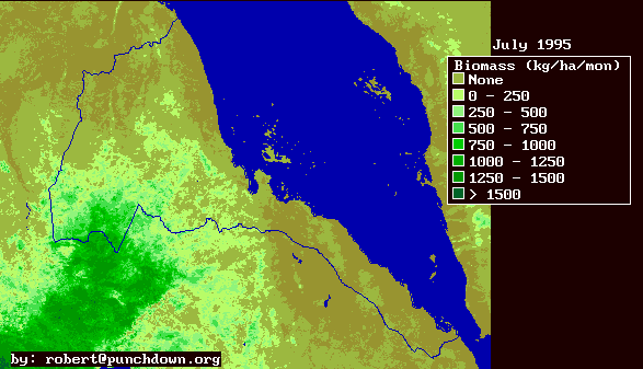
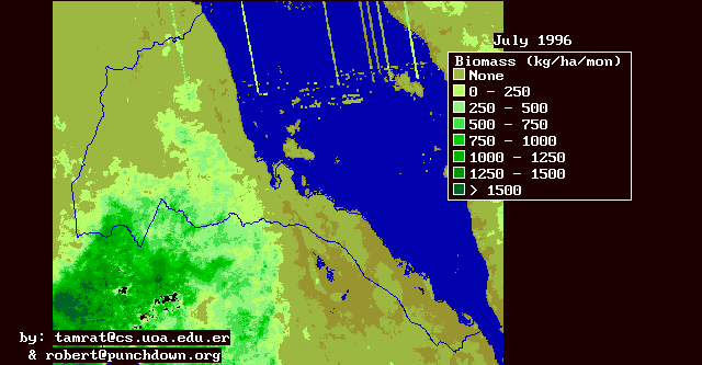
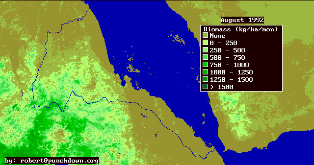
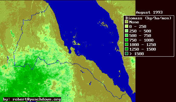
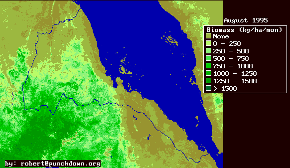
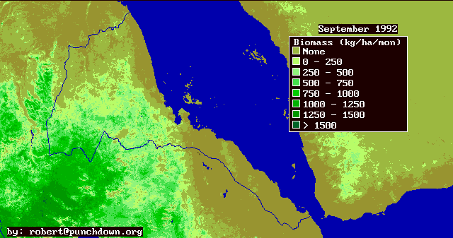
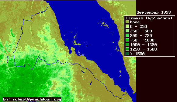
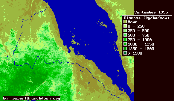
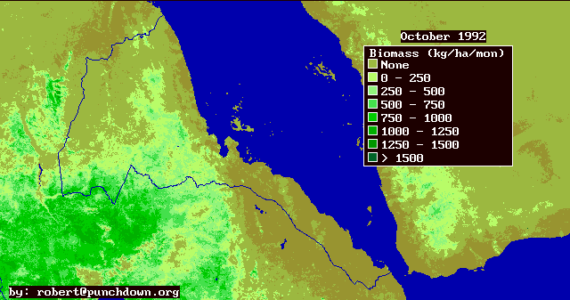
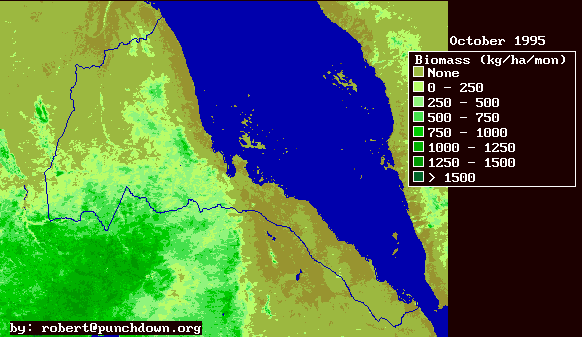
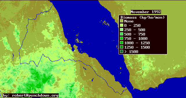
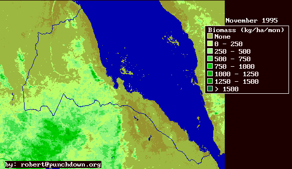
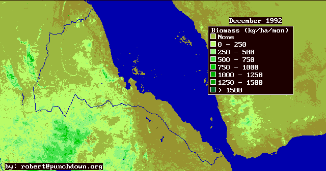
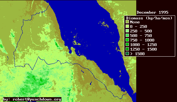
Biomass production and its geographic distribution is important for energy resource assessment, environmental management, and national development planning for several interrelated reasons.
First of all, biomass is the primary source of energy in Eritrea. Approximately 80% of national energy supply comes from biomass, and most of this is burned for cooking in the household energy sector. Biomass energy supply shortages in the biomass sector have lead to increasing fuel wood prices, increasing use of dung as a fuel, deforestation, environmental degradation, and a decreased delivery of useful household energy. Examination of biomass production can aid in the assessment of the severity of the problem and the geographic distribution of biomass supply shortages.
Secondly, vegetative production and its spacial and temporal patterns are a key element of environmental assessments. Gross vegetative productivity differences are associate with different ecological biomes. Thus vegetative production maps can aid in identifying the diversity of ecological zones in Eritrea and in developing an environmental management and preservation plan that retains and preserves the biological and ecological diversity of Eritrea's environmental resources.
This information has been prepared by Robert Van Buskirk. Please send any questions, queries or encouragement to: robert@punchdown.org
Last update by rvb July 27, 1998.