Potential Temperature Maps:
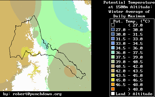
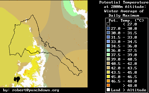
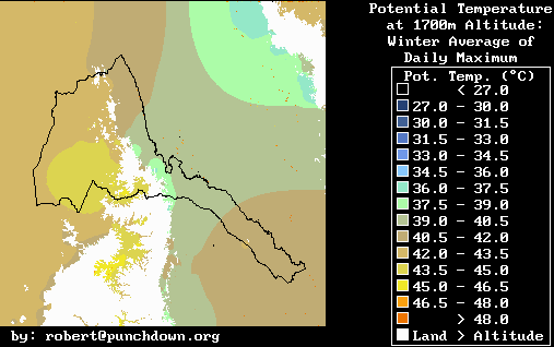
Winter
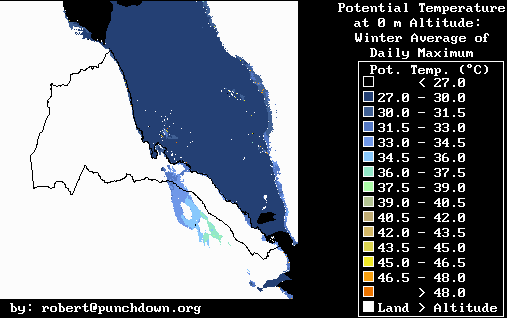
@ 0 meters
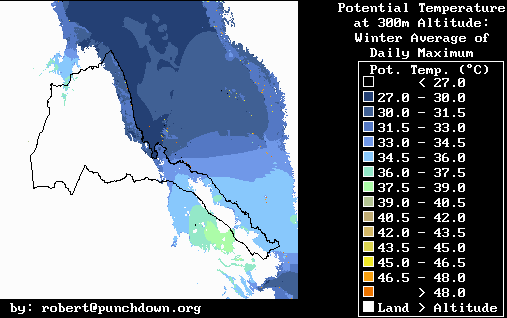
@ 300 meters
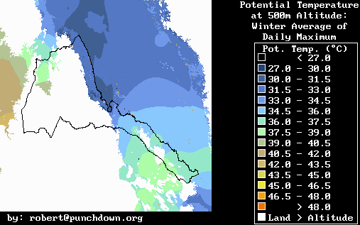
@ 500 meters
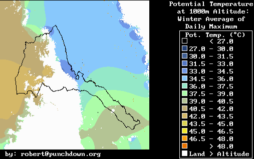
@ 1000 meters
@ 1500 meters
@ 1700 meters
@ 2000 meters
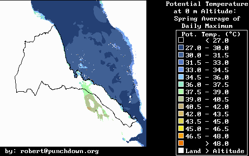
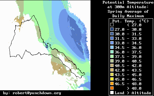
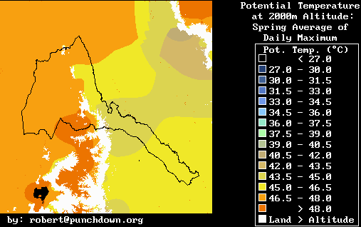
Spring
@ 0 meters
@ 300 meters
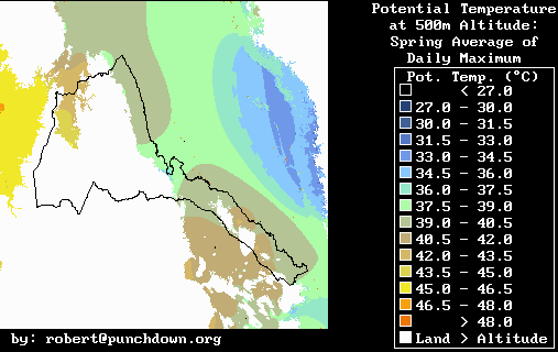
@ 500 meters
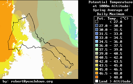
@ 1000 meters
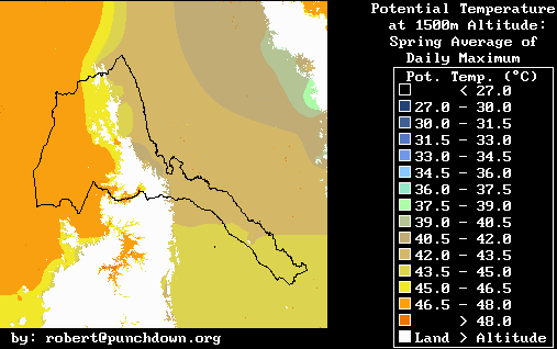
@ 1500 meters
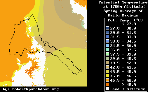
@ 1700 meters
@ 2000 meters
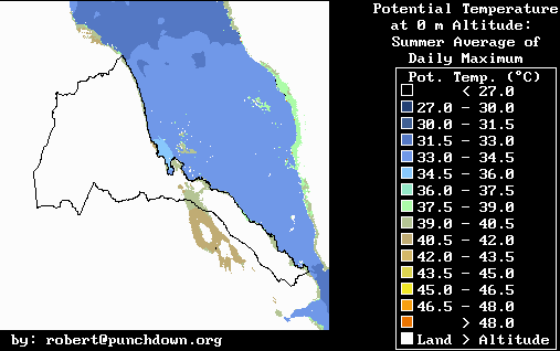
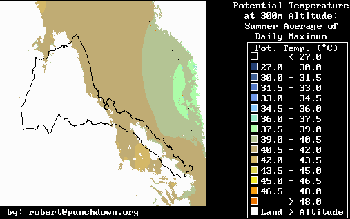
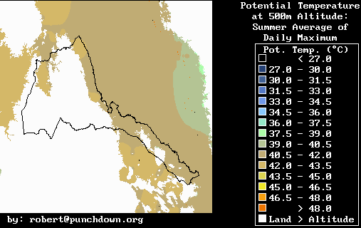
Summer
@ 0 meters
@ 300 meters
@ 500 meters
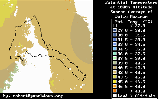
@ 1000 meters
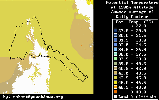
@ 1500 meters
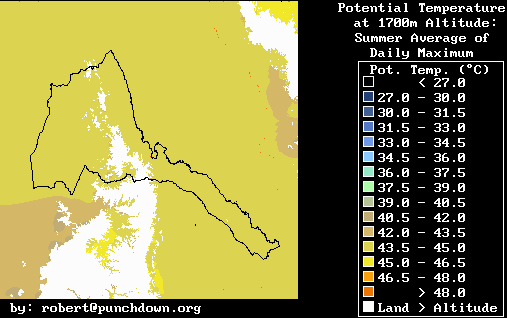
@ 1700 meters
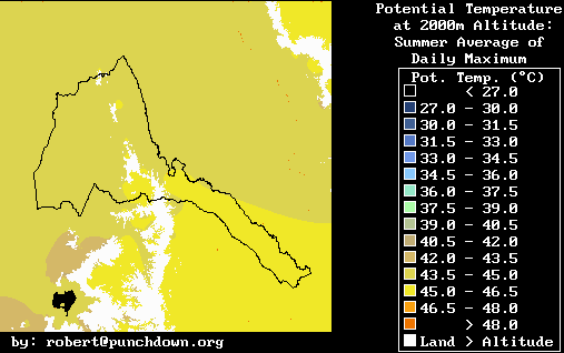
@ 2000 meters
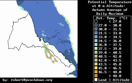
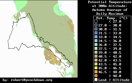
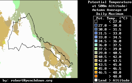
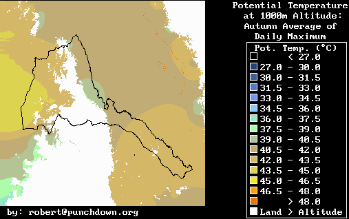
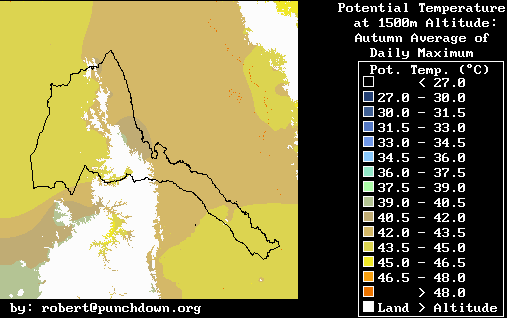
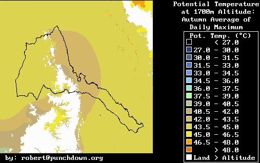
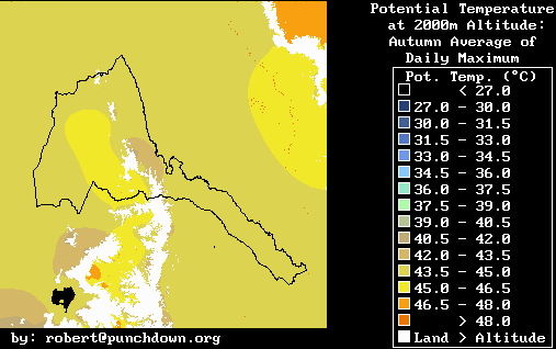
Autumn
@ 0 meters
@ 300 meters
@ 500 meters
@ 1000 meters
@ 1500 meters
@ 1700 meters
@ 2000 meters
The images illustrate the potential temperature at fixed altitudes. The potential temperature is the temperature that the air would have if it was brought to sea level without heat exchange. The calculations presume a dry adiabatic (no heat exchange) lapse rate (rate of temperature change with altitude) of 0.0098 °C/meter. This means that the actual air temperature is the potential temperature minus 0.0098 times the altitude in meters. The atmospheric potential temperature field is presented in fixed altitude slices where the potential temperature is shown as a function of latitude and longitude. If the mountains or land is at an elevation higher than the altitude in question, this higher-altitude land areas are shown in white.
A typical atmospheric potential temperature maps is shown above. This map shows potential temperatures at 1700 meters altitude during the heat of the day. Those areas of the Eritrean and Ethiopian highlands which are above 1700 meters are shown in white, while the other colors indicate the potential temperature of the air at 1700 meters altitude. It can be seen that at this altitude that the air on the eastern side of the highlands is about five degrees cooler than the air on the western side of the highlands. Specifically, over the western lowlands of Eritrea the potential air temperature is about 44 degrees which is equivalent to an actual air temperature of 27 degrees Celcius. Meanwhile along the eastern side of the highlands the potential air temperature is about 39 degrees and the actual air temperature is about 22 °C at 1700 meters.
Air temperatures are obtained through a Laplacian extrapolation of
surface temperatures. To obtain the temperature estimates
a fairly simple extrapolation technique of surface temperatures was used.
Since we have fairly accurate maps of surface temperatures (standard meteorological
shelter temperatures taken at two meters height in the shade), we used
these to provide rough estimates of atmospheric temperatures. The
assumption of the estimation technique is that the elevation variations
of surfaces of constant potential temperature satisfy a horizontal Laplace's
equation. This assumption allows us to extrapolate potential temperature
measurements along mountain slopes to the surrounding atmosphere.